


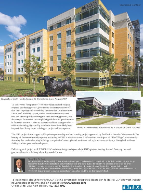
If you divided up a city, how much green space would each resident get? Geotab has analyzed map data to measure three key land uses and to show the different population densities.
Using OpenStreetMap data, Geotab generated maps of 15 major American cities including buildings, roads, and green urban spaces, such as parks. Road widths were calculated using OpenStreetMap data where available, supplemented with city infrastructure manuals and aerial imagery.
These maps were then used to measure total areas and divided by population (latest U.S. Census estimates) for the per-person figures. City boundaries are from U.S. Census TIGER/Line, other map shapes © OpenStreetMap contributors. Research was conducted in April 2019.
CITY:
MIAMI Florida
Population 463,347
Green Space 2.8 sq mi
Roads 8.6 sq mi
Buildings 10.1 sq mi
PER PERSON:
MIAMI Florida
Population 463,347
Green Space 166 sq ft
Roads 517 sq ft
Buildings 606 sq ft
GEOTAB
Geotab is a global leader in IoT and connected transportation, helping businesses leverage data and analytics to better manage their fleet.